At the border between South and North Tyrol, thus between Italy and Austria, the 3,463 m high Cima di Malavalle is located
Image gallery: Cima di Malavalle
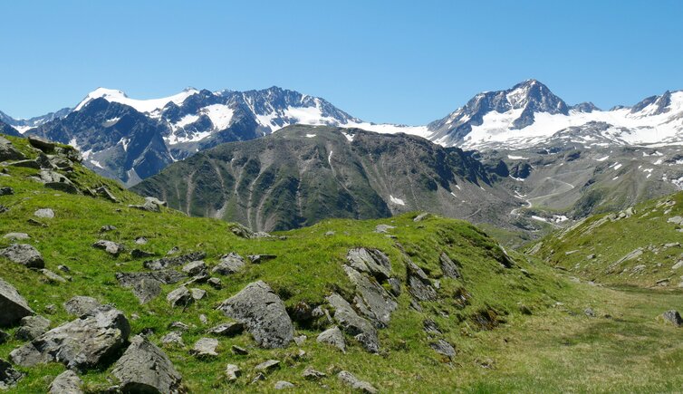
About 7 km far away from the Rombo Pass, Mt. Cima di Malavalle is located in the main ridge of the Stubai Alps. Therefore it can be found west of the South Tyrolean Val di Fleres and south-west of the North Tyrolean Stubaital. Neighbouring mountains are Mt. Cima del Prete (3,456 m a.s.l.) and Mt. Hohes Eis (3,392 m a.s.l.). Also Mt. Pan di Zucchero, the highest peak in the Stubai Alps, can be found here. In 1869 Mt. Cima di Malavalle was climbed for the first time by Richard Gutberlet and his companions via the north ridge. Still nowadays, this route is the normal path.
Base for this hike either is the Cima Libera or Gino Biasi Mountain Huts ( (3,143 m a.s.l. resp. 3,190 m a.s.l.). From there, the high alpine hike proceeds in three hours via the Malavalle Glacier up to the Malavalle Wind Gap, and across the north ridge to the summit. The mountain - Sonklarspitze in German - was named after Carl Albrecht Sonklar von Innstädten, an imperial-royal geographer, one of the developer of the Eastern Alps and a pioneer in research of the Alps in the 19th century. In winter, however, the majestic Cima di Malavalle is a popular destination among ski tourers.