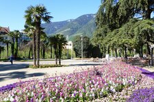
The loop around Lake San Valentino alla Muta runs through a protected biotope and reveals fantastic views of the Ortles Alps
Image gallery: Hike around the Lago di San Valentino alla Muta lake


The circular trail around Lake San Valentino alla Muta in the eponymous village is the ideal nature walk for this June afternoon. We start in San Valentino alla Muta, where we find a few free parking spaces near the village centre and the Mary Help of Christians Chapel.
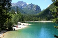
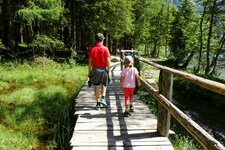
On the shore, we meet some friendly goats and a sign for the "Seerundweg" (lake loop trail): The route always follows path no. 1. Wooden boardwalks along the water, stretches of forest, and the occasional coot take turns. Coots belong to the crane-like birds, but they swim like ducks and are a peaceful sight. They are a common sight here at Lake San Valentino alla Muta - the species benefits from the well-developed shore vegetation and reed beds, which make it a popular nesting ground.
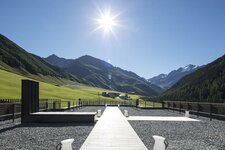
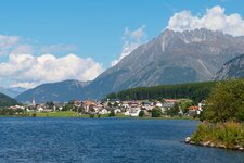
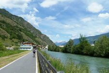
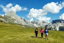
Time and again, benches invite us to take a rest or enjoy a photo session. In the distance loom the giants of the Ortles Alps, whose peaks are glaciated and therefore still white. After a short stretch of forest, we are greeted by a few horses and donkeys from a nearby animal sanctuary. Now, the route follows the cycle path for a short distance, which gets slightly steeper in some places.
We stop at the Zeress restaurant for a sweet break. Following the cycle path, we soon reach an intersection where the "Seerundweg" sign leads down to the shore, away from the cycle route.
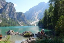
A boardwalk leads us across the water to the reed bed. Finally, we see the boats: Motorboats are banned on the lake which is called Haidersee in German, though electric motors are allowed. From April to October, recreational anglers can also be found here - surfing, sailing, and kitesurfing are not permitted during this time. The path leads us along the shore to the so-called Fischerhäuser (fishermen's houses) and then back to the parking spaces. Ideal for a leisurely summer day!
Author: RB
Experienced: June 2026
-
- Starting point:
- parking space along the Via Vittorio Veneto road, San Valentino alla Muta
-
- Overall time:
- 01:30 h
-
- Total route length:
- 4,9 km
-
- Altitude:
- from 1.449 m to 1.464 m
-
- Altitude difference (uphill | downhill):
- +73 m | -73 m
-
- Signposts:
- no. 1 (Seerundweg / Giro del lago)
-
- Resting points:
- bars and coffee shops in San Valentino alla Muta, Zeress restaurant along the lake loop trail
-
- Recommended time of year:
- Jan Feb Mar Apr May Jun Jul Aug Sep Oct Nov Dec
-
- Download GPX track:
- Hike around the Lago di San Valentino alla Muta lake
-
- More information:
- The overall time shown above refers to the walking time only, not including breaks.
If you want to undertake this hike, we recommend checking the weather and trail conditions in advance and on site before starting this hike!