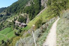
The Merano High Route stage from Plan to the hamlet of Montaccio passes the mountain farms of Cresta
Image gallery: Cresta


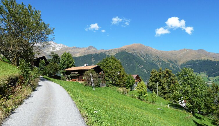
On the western side of the Val Passiria, several groups of farms belong to the municipality of San Martino. One of these is Cresta (Christl). It sits on a sunny hill, exactly where the valley branches off westwards towards Moso and the mighty Passo del Rombo. The farms that make up this small centre are called Christlhof, Gotteshof, Paster Schwarz, Gorges, and Grasl.
The slopes above them are protected within the Gruppo di Tessa Nature Park. The small Via della Cresta, a mountain road, then ends at the Unterweger and Oberweger farms. Walkers frequently pass through here, as the multi-day tour through the Texel Group along the Merano High Route is highly popular. The hike can start at various locations in Merano and surroundings, including the Val Passiria. One stage begins in the Upper Val Passiria and leads through the shady forests of the Valle di Plan via Ulfas, Cresta, and Montaccio to the sunny meadows above San Martino.
Hikes also start in Cresta, and it is a common place to take a break. The Christlhof mountain inn sits in a quiet and idyllic spot at an altitude of 1,100 metres in the centre of the hamlet. It provides walkers with a wonderful panoramic view of the Sarentino, Stubai, and Oetztal Alps.
Mountain bikers rest here after the cycle route from San Martino to Pianolargo and Cresta. It covers an ascent of 682 vertical metres. Because of its location above the road junction towards the Upper Val Passiria, you can reach the Plan Skiing Area and its cross-country ski trails in about a 20-minute drive. These tracks lead from Plan into the Valle di Lazins or towards Innerhütt.