An impressive trail through the gorge has opened along the upper reaches of the Passirio, between San Leonardo and Moso
Image gallery: Hike along the “Passerschluchtweg”


A massive rockfall at the Prantlwand, approximately two kilometres before Moso, swept away a 30 to 40-metre section of a metal walkway on the Passirio Gorge Path on 23 February 2026. The path is currently impassable. Further information is available from the tourist office in Moso or San Leonardo, or will be provided here as soon as it becomes available. (status: April 2026)
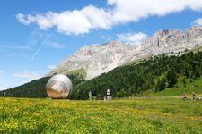
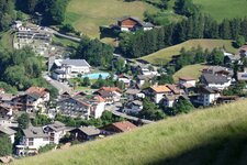
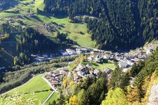
The power of water plays a significant role in the Val Passiria valley. It is particularly striking between Moso and San Leonardo: The Passirio Gorge, called Passerschlucht or Gola del Passirio, was carved into the rocks by the river and fitted with boardwalks and steel cables a few years ago, making it possible to experience it on an impressive hike. We park our car near Zogghof campground in San Leonardo in Passiria: The village is also easily accessible by bus from Merano.
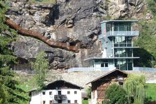
We follow the sign for the "Passerschlucht". First, it is an asphalted road, then a gravel track, marked with the number 1. After a few minutes, we reach a bridge on our left, which we cross, then turn right to follow the path into the forest. Soon after, we see the first steel structures. Boardwalks, bridges, and viewpoints alternate, and we even pass an old, abandoned power plant.
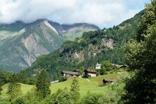
The path leads us across a bridge to the junction for Moso in Passiria. Here, we follow path number 1A, which leads quite steeply uphill and merges with another junction after ten minutes. At this point, we keep right, follow the signs towards Moso and the Stieber Waterfall, and hike through the Val Passiria alpine meadows. Soon, the path joins an asphalted road: We keep right, leave the Sanderbad inn behind us, and follow the small path that descends steeply.
We enjoy the spectacular view of the Stieber Waterfall, where the Rio di Plan plunges 19 metres and then another 18 metres down into the Passirio River. Now we hike to the state road near Moso in Passiria, walk 300 metres downhill, and cross a covered wooden bridge. Heading right and downhill is the next junction, where we follow the signs for the Passirio Gorge. At the next intersection, we cross the embankment to the right and find ourselves back on the outward path.
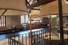
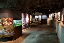
We follow this trail back to the car park. Note: The hike is classified as easy, but at five hours of actual walking time, it is quite long. It can be easily combined with a visit to the Bunker Mooseum in Moso in Passiria or the MuseumPasseier at the Sandhof farm in San Leonardo in Passiria, which is dedicated to the Tyrolean freedom fighter Andreas Hofer.
Authors: Elena & Luca
Experienced in: May 2020
Last updated: 2026
-
- Starting point:
- sports ground in San Leonardo in Passiria (665 m a.s.l.)
-
- Overall time:
- 05:00 h
-
- Total route length:
- 17,3 km
-
- Altitude:
- from 665 m to 1.011 m
-
- Altitude difference (uphill | downhill):
- +795 m | -795 m
-
- Signposts:
- no. 1, 1A
-
- Destination:
- Passirio bridge near Moso in Passiria
-
- Resting points:
- none along the path
-
- Recommended time of year:
- Jan Feb Mar Apr May Jun Jul Aug Sep Oct Nov Dec
-
- Download GPX track:
- Hike along the “Passerschluchtweg”
-
- More information:
- The overall time shown above refers to the walking time only, not including breaks.
If you want to undertake this hike, we recommend checking the weather and trail conditions in advance and on site before starting this hike!