A late summer hike to the Rifugio Puez, set in a unique landscape, and back to Selva Gardena through the Vallunga valley
Image gallery: Hike to the Puez Hut on the Puez plateau


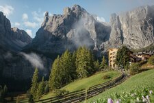
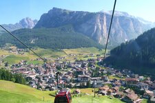
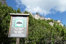
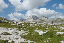
The Puez plateau in the Puez Group is known for its unique scenery, a combination of alpine pastures, mountain lakes and a distinctive geological landscape. It is located well over 2,000 metres above sea level in the Puez-Odle Nature Park in the Dolomites and is the destination of our beautiful late summer hike. We start in Selva Gardena, where we take the Dantercepies Lift towards Passo Gardena. The top station is our starting point and the valley station will be our finish point, making the hike a circular route.
As soon as we arrive, we are captivated by the view of the solitary Sassolungo, which gives way to the Alpe di Siusi on the right. Above us, the peaks of the Cir Group rise into the sky. The path first takes us to the Jimmi Hut, where we join the main trail of our hike, the Dolomites High Route no. 2. It leads up in steep switchbacks to the Passo Cir at an altitude of 2,465 metres. This is followed by an easy descent into the Val Chedul and on to the second pass, the Passo Crespëina.
After the pass, which at 2,531 metres marks the highest point of our hike, we reach the unique landscape of the Puez plateau. It is the ideal spot for a short break! From here, it is another 80-minute walk to the Rifugio Puez. Passing Lake Crespëina, which lies in a hollow, and always following trail marker 2, we soon reach the Forcella di Ciampei at an altitude of 2,359 metres.
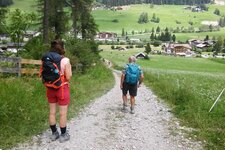
Incidentally, this small mountain lake is known locally as Lech de Crespëina. The route continues along the western edge of the Gherdenacia plateau. Soon we reach the Puez Hut (2,475 m a.s.l.). A stop here is well worth it, and we have certainly earned it! After a bite to eat, we head back down into the valley, descending steeply into the Vallunga valley - still within the Puez-Odle Nature Park. The Vallunga is a destination for hiking and other activities throughout the year.
It is also part of the Europe-wide Natura 2000 network of protected areas, which aims to conserve natural habitats. After a final short walk, we arrive back at the Dantercepies valley station in Selva Gardena, concluding this wonderful five-hour tour.
Authors: Elena & Luca
Experienced in: September 2019
Last updated: 2025
-
- Starting point:
- mountain station of the Dantercepies Cable Car in Selva Gardena (2,291 m a.s.l.)
-
- Overall time:
- 05:00 h
-
- Total route length:
- 16,1 km
-
- Altitude:
- from 1.609 m to 2.531 m
-
- Altitude difference (uphill | downhill):
- +1154 m | -1154 m
-
- Signposts:
- 12A, 2 (Dolomiten-Höhenweg)
-
- Destination:
- Puez Mountain Hut (2,475 m a.s.l.)
-
- Resting points:
- Jimmi Mountain Hut, Puez Mountain Hut
-
- Recommended time of year:
- Jan Feb Mar Apr May Jun Jul Aug Sep Oct Nov Dec
-
- Download GPX track:
- Hike to the Puez Hut on the Puez plateau
-
- More information:
- The lowest point of the route is the Dantercepies Lift's valley station in Selva Gardena at 1,609 metres, and the highest point is the Passo Crespëina at 2,531 metres. The total time indicated above refers to the pure walking time, excluding breaks and cable car journeys.
If you want to undertake this hike, we recommend you to check the weather and trail conditions in advance and on site before setting out.