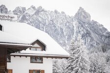
The autumn hike to the Corno di Fana di Dobbiaco can be perfectly combined with a stop at the Corno di Fana Mountain Hut
Image gallery: Summit tour to the Corno di Fana


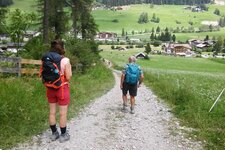
We begin our autumn hike in Kandellen near Valle San Silvestro in the Upper Val Pusteria, a mountain village near Dobbiaco. Now the ascent begins: Path no. 25 first leads us for about a kilometre on asphalt and then on a gravel track to a junction. We keep left and follow path no. 25A quite steeply up into the forest. As soon as it clears, meadows appear and behind us a beautiful view of the Monte Cristallo opens up.
After an hour and a half, the hike takes us to the Bergalm Hut at 2,090 metres. Afterwards, the route continues steeply upwards to the area called "Seelandboden" at 2,341 metres and to a junction: On the right, we can go directly to the Corno di Fana Hut (Bonner Hütte), and on the left, to the Forcella di Fana ridge on the border with Austria. We decide on the latter option. Once at the top, only a narrow pass separates us from Austrian territory. The view is magnificent!
Path no. 8 leads us past some interesting old buildings: They are part of the "Vallo Alpino" defensive wall and were used as casemates before the Second World War. After another hour and a half, we reach our destination: the summit of the Corno di Fana (Toblacher Pfannhorn).
The panoramic view makes up for all the effort: The Sesto Dolomites, the Three Peaks of Lavaredo, the Monte Cristallo and the Grossvenediger in Austria stretch out majestically before us. We then descend to the Corno di Fana Mountain Hut and path no. 25. A slice of cake is just what we need now. Afterwards, we head down a gravel track in steep hairpin bends to a gate.
There, we turn right (note, there is no sign here!) and take the shortcut through the forest until we rejoin the main path. If you want to skip the shortcut, simply continue along the gravel track. At the junction with path no. 25A, we turn onto it and soon after reach the car park in Kandellen.
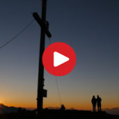
Note: We did the hike as a day tour - the video alternatively shows a two-day tour with a sunrise. The paths are well-signposted and in good condition, but the sometimes steep ascent requires a good level of fitness. Be aware of possible snowfall in autumn!
Authors: Elena & Luca
Experienced: October 2023
Last update: 2025
-
- Starting point:
- parking space in Kandellen, Dobbiaco (1,576 m a.s.l.)
-
- Overall time:
- 04:00 h
-
- Total route length:
- 12,7 km
-
- Altitude:
- from 1.576 m to 2.668 m
-
- Altitude difference (uphill | downhill):
- +1092 m | -1092 m
-
- Signposts:
- 25, 25A, 8, 25A
-
- Destination:
- summit of Mt. Corno di Fana (2,668 m a.s.l.)
-
- Resting points:
- Corno di Fana Mountain Hut
-
- Recommended time of year:
- Jan Feb Mar Apr May Jun Jul Aug Sep Oct Nov Dec
-
- Download GPX track:
- Summit tour to the Corno di Fana
-
- More information:
- Be aware of possible snowfall in autumn! The overall time shown above refers to the walking time only, not including breaks or stops at mountain huts.
If you want to undertake this hike, we recommend you to check the weather and trail conditions in advance and on site before setting out.