This high-alpine-hike leads to the Vedrette di Ries Mountain Hut, which is surrounded by several peaks higher than 3,000 metres
Image gallery: Hike from Anterselva to the Vedrette di Ries Hut


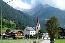
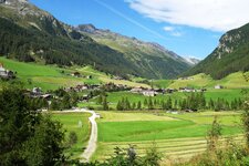
On a warm summer day we hike from Anterselva di Mezzo to the Vedrette di Ries Mountain Hut (Rieserfernerhütte) at 2,792 metres above sea level. Plan at least four hours for the ascent (and three hours for the descent). Due to the high altitude of the path and the lack of trees above the tree line at 2,100 metres, we start at dawn. We pass the Klammbach Waterfall.
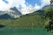
After the Berger Hut we proceed uphill in a forest. Afterwards we follow the trail signs of the path no. 3 and continue to walk along a steep slope. Once we have left the last trees behind us, we are embraced by a stunning view on the Valle di Anterselva, the Dolomites in the south and some summits, such as the Croda Nera and the Monte Magro in the Rieserferner Group.
Before reaching the Rieserferner Bivouac we have to cross a stream twice and continue to walk for further 50 minutes without being able to recognise the Vedrette di Ries Hut. After a short time we have to face some wooden and stone stairs construction with a steel rope on one side. At first we are delighted not to have to walk on slippery stones anymore, but after a few instants our delight vanishes as we realise how hard it is to climb more than 800 steps before we see the hut.
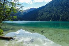
Don't underestimate the last stretch! On the Forcella Valfredda ridge we have the pleasure to admire a small snowfield whose melting snow has created a small lake. The path above it leads us to the hut where a fresh wind whips around us as we enter the hut to have a delicious lunch.
Finally, we take the same path to return to Anterselva. It is possible to reach the Vedrette di Ries Mountain Hut also from Anterselva di Sopra or Riva di Tures in about four hours. Two of the most spectacular hiking destinations in the vicinity of the hut are the 3,273-metre high summit of the Monte Magro and the Monte Nevoso (3,358 m a.s.l.).
Author: AD
Experienced: agosto 2024
Last updated: 2026
-
- Starting point:
- Anterselva di Mezzo sports ground (1,261 m a.s.l.)
-
- Overall time:
- 07:00 h
-
- Total route length:
- 13,9 km
-
- Altitude:
- from 1.261 m to 2.798 m
-
- Altitude difference (uphill | downhill):
- +1537 m | -1531 m
-
- Signposts:
- no. 3
-
- Destination:
- Vedrette di Ries Mountain Hut (2,798 m a.s.l.)
-
- Resting points:
- Berger Hut (May to October), Vedrette di Ries Mountain Hut (June to September)
-
- Recommended time of year:
- Jan Feb Mar Apr May Jun Jul Aug Sep Oct Nov Dec
-
- Download GPX track:
- Hike from Anterselva to the Vedrette di Ries Hut
-
- More information:
- The total time indicated above refers to the walking time only, excluding breaks.
If you want to undertake this hike, we recommend checking the weather and trail conditions in advance and on site before starting this hike!