Hiking in the Upper Val Venosta is an experience for all the senses: Eleven combinable stages show you the beauty of the area
Image gallery: Hike on the 360° Upper Val Venosta Panorama Trail
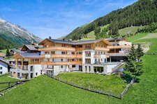
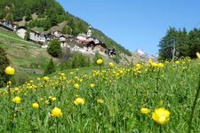
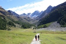
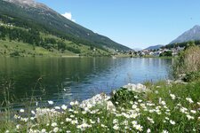
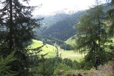
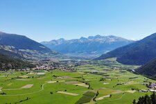
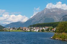
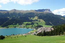
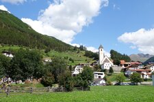
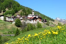
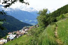
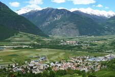
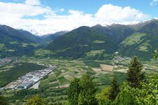
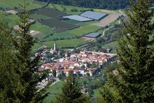
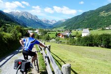
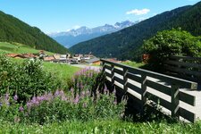
Views of the highest peaks in South Tyrol, stops at rustic mountain huts and varied sights: The "360° Upper Val Venosta" multi-day hike is more than just a circular trail. Across eleven stages, it combines the landscape, culture and history of the area, allowing you to experience them first-hand. The start and finish is the Watles valley station in Pramajur in the Upper Val Venosta. Watles is an adventure mountain, known for its play lake and its wide range of activities.
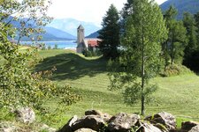
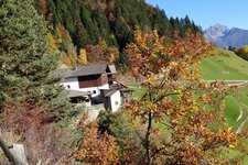
The daily stages are suitable for families and leisure hikers, but you should have some hiking experience to complete the entire route. After around 130 kilometres through the Val Venosta, you return to Mt. Watles. Conveniently, the starting points of the stages are easily accessible by public transport or hiking taxis, and the logo - a yellow, green and blue circle - accompanies you on the entire tour. Highlights such as the source of the Adige River, the mountaineering village of Mazia, and the smallest town in the Alps are just some of the main attractions.
The stages at a glance:
1. Pramajur - San Valentino alla Muta
4 hours 30 minutes - 11.9 km - easy - 380 / 380 metres (ascent/descent)
2. San Valentino alla Muta - Resia
5 hours 45 minutes - 17.8 km - medium - 1,010 / 921 metres (ascent/descent)
3. Resia - Curon Venosta - San Valentino alla Muta
3 hours - 10.9 km - medium - 287 / 363 metres (ascent/descent)
4. San Valentino alla Muta - Planol
4 hours - 10.6 km - easy - 512 / 374 metres (ascent/descent)
5. Planol - Mazia
4 hours - 12.6 km - difficult - 500 / 512 metres (ascent/descent)
6. Mazia - Sluderno
3 hours - 7.2 km - medium - 104 / 762 metres (ascent/descent)
7. Sluderno - Prato allo Stelvio
3 hours 30 minutes - 10.9 km - medium - 361 / 373 metres (ascent/descent)
8. Prato allo Stelvio - Glorenza
4 hours - 11.8 km - medium - 409 / 404 metres (ascent/descent)
9. Glorenza - Tubre in Val Monastero
4 hours - 11.4 km - medium - 508 / 176 metres (ascent/descent)
10. Tubre in Val Monastero - Slingia
7 hours 30 minutes - 17.4 km - difficult - 1,417 / 947 metres (ascent/descent)
11. Slingia - Pramajur
5 hours 30 minutes - 14.5 km - medium - 627 / 637 metres (ascent/descent)
-
- Starting point:
- Pramajur/Watles valley station
-
- Overall time:
- 19:40 h
-
- Total route length:
- 134,4 km
-
- Altitude:
- from 883 m to 2.358 m
-
- Altitude difference (uphill | downhill):
- +6630 m | -6630 m
-
- Destination:
- Pramajur/Watles valley station
-
- Resting points:
- Brugger Hut, Plagött, Planol restaurant, Gemse inn, Rainalterhof, Birkenhof, Spondigna bar at the train station, Fischerstube, Laudes Hut, Slingia Hut, Sesvenna Hut, Plantapatsch Hut, Höfer Hut, and all restaurants in the single villages
-
- Recommended time of year:
- Jan Feb Mar Apr May Jun Jul Aug Sep Oct Nov Dec
-
- Download GPX track:
- Hike on the 360° Upper Val Venosta Panorama Trail
-
- More information:
- 43.5 hours of walking time in total for alle 11 day stages