From one sight to the other: A recommendable mountain tour leads from the Mining World in the Val Ridanna valley to South Tyrol’s highest located mountain hut
Image gallery: Hike to the Gino Biasi al Bicchiere Mountain Hut
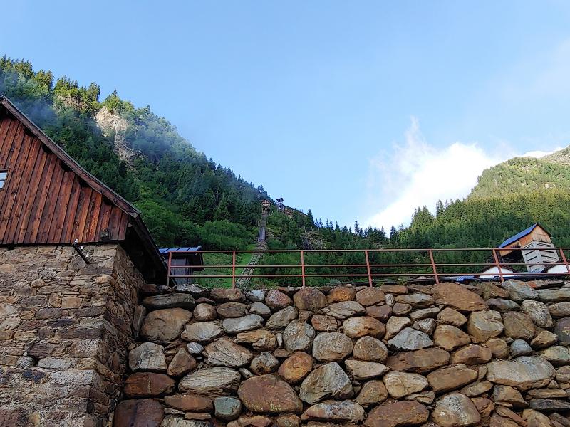
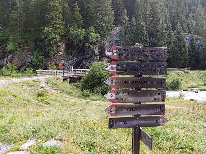
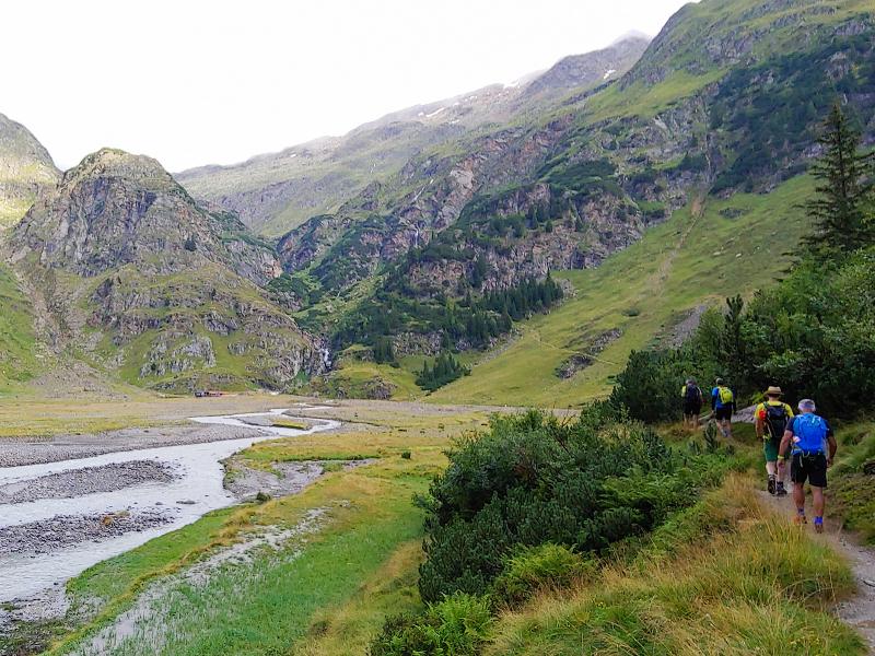
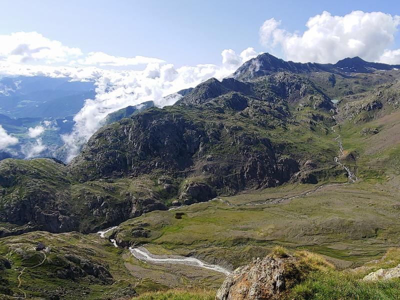
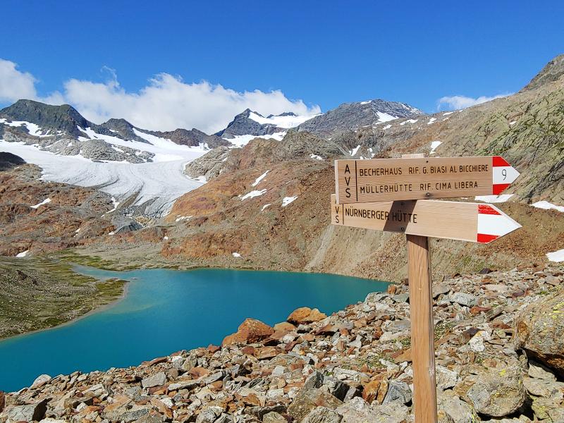
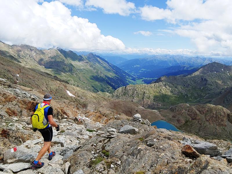
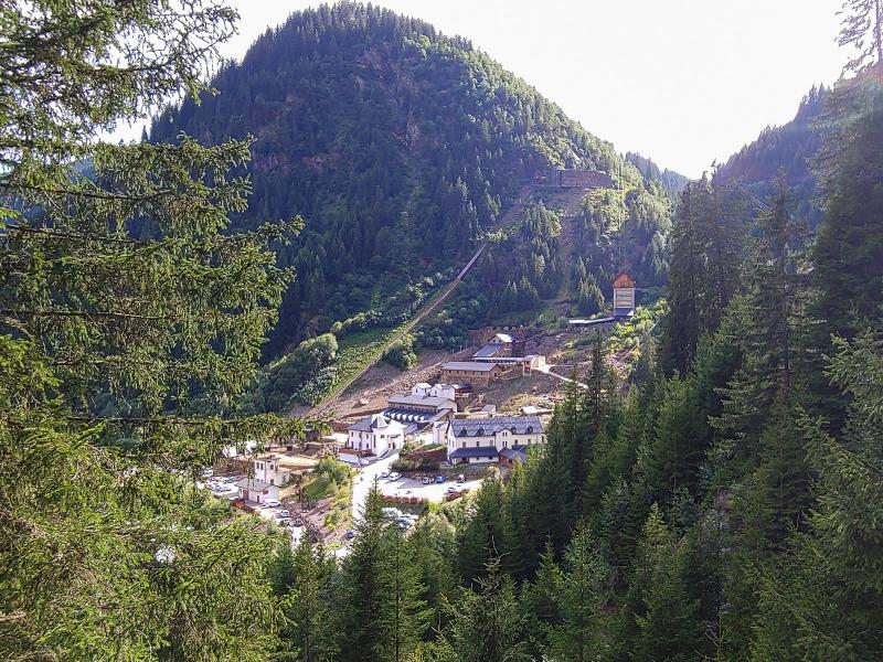
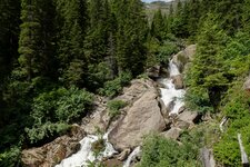
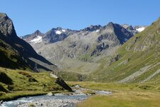
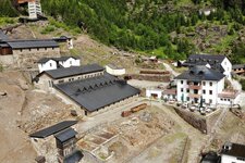
On a beautiful August day we decide to do a hike at lofty heights which starts at a very special sight: the Ridanna Mining World. It is one of the four locations of the South Tyrol Museum of Mining which includes also the highest located mine of Europa on Mt. Monteneve. Our tour starts at the parking space of the Mining World: On the first section, a stony forest trail follows - first steep and then flatter - the course of a brook. After approx. 2 km, right before the Aglsboden Mountain Pasture, we cross the brook on a small dam. A sign indicates the Aglsboden, a high valley basin. Other rest points follow: first the Rif. Vedretta Piana (Grohmannhütte, in German, at 2,253 m a.s.l.) and - 340 m higher resp. 1 km further on - the Rif. Vedretta Pendente (Teplitzerhütte).
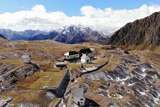
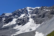
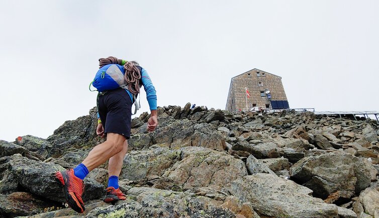
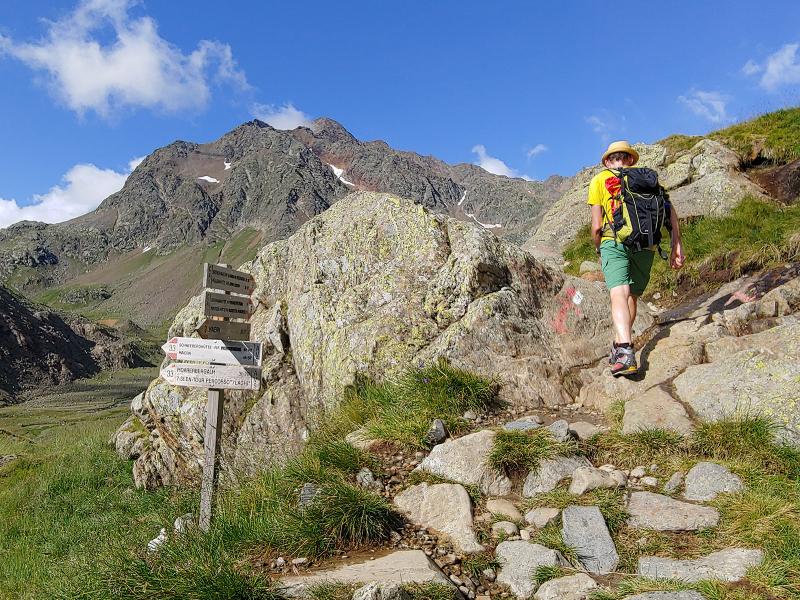
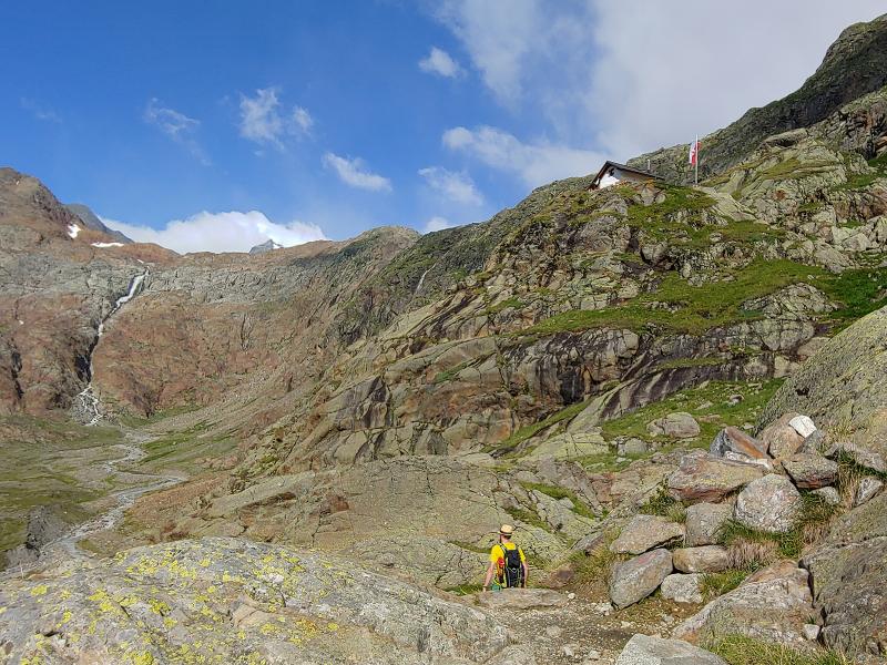
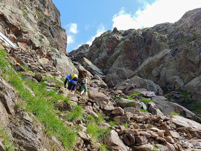
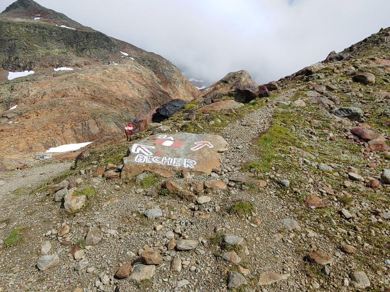
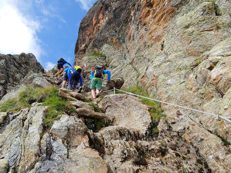
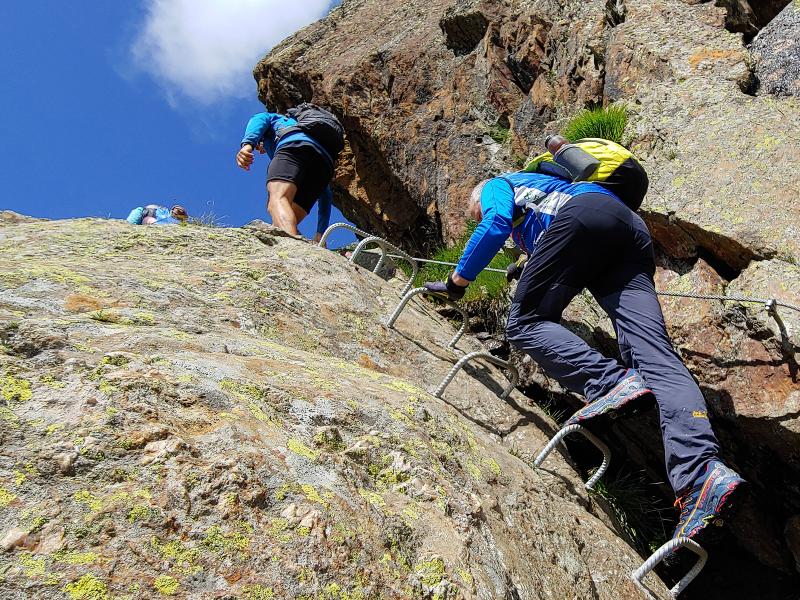
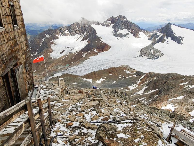
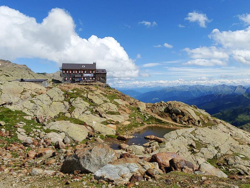
Those who have good eyes are able to see already the Gino Biasi al Bicchiere Mountain Hut in the distance! After a short stop with coffee break, the longest section is ahead of us - the 4.5 km long trail to the Becherhaus, the German name of the mountain hut. We walk past the turquoise Malavalle Lake and cross some snow fields: The last one had to be bypassed in the past but today we can simply cross it due to the general increase of temperatures. Now we reach some stairs secured with ropes, which represent the last ascent to the mountain hut. The last fork leads to the Rif. Cima Libera (Müllerhütte) on the left hand side, approx. 1 km far away.
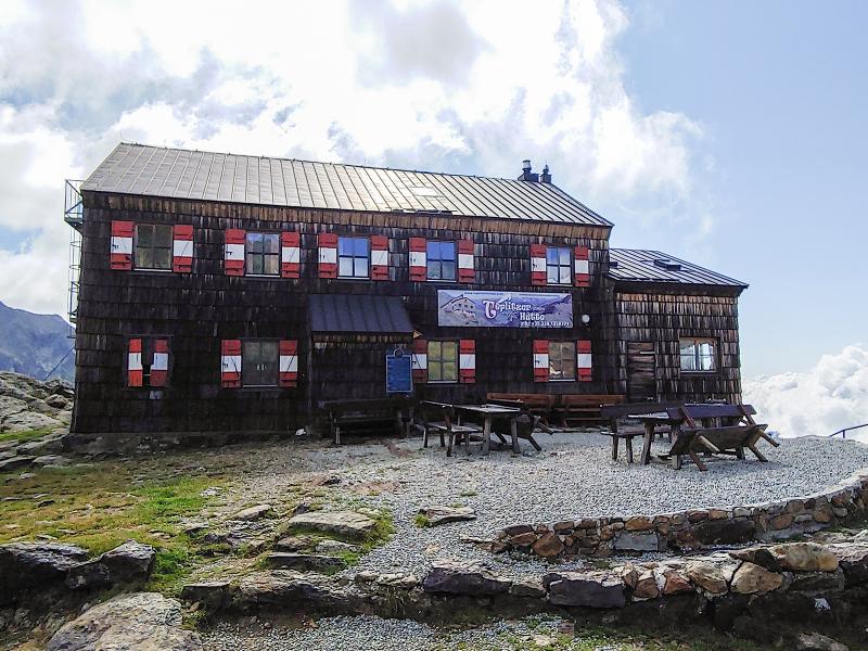
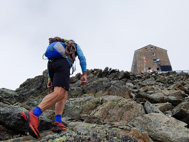
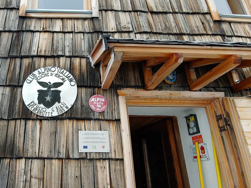
We follow the trail on the right to the Rif. Gino Biasi al Bicchiere at 3,198 m a.s.l., the highest located mountain hut of South Tyrol. After a 5-hour ascent we reach our destination and the highest point of our mountain tour. We strengthen ourselves with a hearty noodle soup and a traditional Kaiserschmarrn, a kind of fluffy shredded pancake served with icing sugar and jam, before we turn back to our starting point on the same way. Climbing skills are advantageous on the last km before the mountain hut, there are stony stairs with rope to overcome.
Author: AP
-
- Starting point:
- parking space at the Ridanna Mining World
-
- Overall time:
- 11:00 h
-
- Total route length:
- 25,0 km
-
- Altitude:
- from 1.412 m to 3.198 m
-
- Altitude difference (uphill | downhill):
- +1786 m | -1786 m
-
- Signposts:
- no. 9
-
- Destination:
- Rif. Gino Biasi al Bicchiere, the highest located mountain hut of South Tyrol
-
- Resting points:
- Malga Aglsboden mountain pasture (1,717 m), Rif. Vedretta Piana mountain hut (2,253 m), Rif. Vedretta Pendente mountain hut (2,586 m), Rif. Cima Libera mountain hut (3,201 m), Rif. G. Biasi al Bicchiere mountain hut (3,198 m)
-
- Recommended time of year:
- Jan Feb Mar Apr May Jun Jul Aug Sep Oct Nov Dec
-
- Download GPX track:
- Hike to the Gino Biasi al Bicchiere Mountain Hut
We highly recommend checking the weather and trail conditions in advance and on site before starting this tour.