A spring hike on the slopes of Bolzano, connecting two wonderful promenades of the provincial capital
Image gallery: Sant’Osvaldo and Guncina Promenades


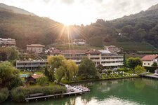
Strictly speaking, meteorological spring has not yet begun, but in the Adige Valley, it arrives earlier thanks to the Mediterranean climate, inviting you outdoors even on mild late-winter days. In the Spring Valley in the neighbouring municipality of Appiano, snowdrops are also already poking their heads out of the ground. A few days ago, a low-pressure system brought snow down to low altitudes, but today there is no trace of it left. We start our hike at the central Piazza Walther square in Bolzano, five minutes from the train station, after a coffee in the sun.
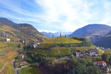
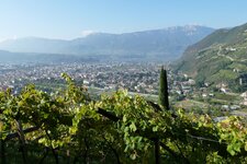
We walk to the Rencio district, where we soon see the sign for "Oswaldpromenade" (Sant'Osvaldo Promenade) on the left. The small road leads up the slope, opening the view to Santa Maddalena on the outskirts, known for the vineyards where the grapes for the Santa Maddalena wine ripen. The Sant'Osvaldo Promenade begins at Hotel Eberle, which has been closed for several years.
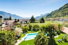
Along the one-hour hike, which runs flat along the slope, we enjoy the magnificent views over the town, the Dolomites and the Valle dell'Adige. The first flowers are blooming on the hillside. Towards the end, we pass the memorial plaque of Karl von Ritter, who planned and built the promenade. Afterwards, the path descends in serpentines to Sant'Antonio, the district of Bolzano at the end of the Talvera Meadows near Roncolo Castle, at the entrance to the Val Sarentino.
We reach the main road via a small bridge and walk left to the junction with the road to San Genesio Atesino, which leads upwards. We follow it for a few minutes, past the Torre Druso tower, then the ascent to the Guncina Promenade follows on the left. Stairs lead upwards: Through the still bare trees, we see the Rio Fago Waterfall. The Guncina Promenade leads us upwards and crosses the main road once. Afterwards, it winds gently down the slope for over an hour to the Wandelhalle covered walkway in Gries. The views of Bolzano are impressive.
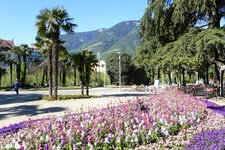
The promenade is dedicated to Archduke Heinrich von Habsburg - Gries, now a district, was once a significant climatic health resort. Walkers are out and about, enjoying the mild day. In Gries, we treat ourselves to an aperitif outdoors before we come back to the centre via the Corso della Libertà road and the Ponte Talvera bridge. We reach the Piazza Walther square in the early evening. A wonderful experience, not too strenuous, with views of Bolzano rarely seen.
Author: MS
Experienced: February 2026
-
- Starting point:
- Piazza Walther square in Bolzano (261 m a.s.l.)
-
- Overall time:
- 02:45 h
-
- Total route length:
- 9,4 km
-
- Altitude:
- from 261 m to 419 m
-
- Altitude difference (uphill | downhill):
- +250 m | -249 m
-
- Signposts:
- signposts "Oswald", "Oswaldpromenade"
-
- Destination:
- Sant'Osvaldo and Guncina Promenades
-
- Resting points:
- bars and coffee shops in the town centre and in Gries
-
- Recommended time of year:
- Jan Feb Mar Apr May Jun Jul Aug Sep Oct Nov Dec
-
- Download GPX track:
- Sant’Osvaldo and Guncina Promenades
-
- More information:
- The total time stated above refers to pure walking time, without breaks and stops for refreshments. With breaks, we were out for about half a day - the tour can also be well combined with a start in the morning and a stop for lunch.
If you want to undertake this hike, we recommend checking the weather and trail conditions in advance and on site before starting this hike!