Over the new Marterloch suspension bridge, South Tyrol’s longest and highest: hike from Avigna to Ponticino
Image gallery: Hike across the Marterloch in the Val Sarentino


Today, we want to take a close look at the longest and highest suspension bridge in South Tyrol. Opened in May 2025, it was built on a water pipeline which supplies water from the Val Sarentino to irrigate agricultural land in San Genesio Atesino. The Marterloch adventure trail leads from Avigna (Afing), a hamlet of San Genesio Atesino, to Ponticino (Bundschen) in Sarentino.
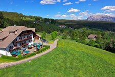
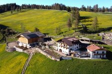
We start our hike in Avigna: We recommend travelling by public transport, as parking is very limited. Moreover, since our destination is Ponticino, we will not return to the starting point. If required, the local tourist board organises a shuttle service from the Moar tavern in Avigna almost to the Marterloch suspension bridge. Today we are exploring on foot.
Trail no. 1 begins above the church in Avigna and leads us slightly uphill along the farm trail. After walking for a good hour, we reach the main attraction of the hike: the 272-metre-long and 130-metre-high suspension bridge over the Marterloch. You need a good head for heights here!
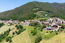
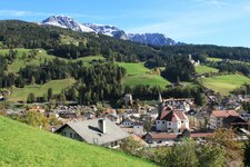
However, we feel safe during the crossing. Afterwards, the path climbs briefly and leads through the forest. Along the way, we pass 20 information boards detailing the history and features of this area. After another hour, we reach Ponticino. From here, we take the bus out of the valley.
Experienced: June 2025
Last updated: 2026
-
- Starting point:
- Avigna near San Genesio Atesino (870 m a.s.l.)
-
- Overall time:
- 02:20 h
-
- Total route length:
- 8,3 km
-
- Altitude:
- from 870 m to 1.038 m
-
- Altitude difference (uphill | downhill):
- +330 m | -283 m
-
- Signposts:
- no. 1, "Marterloch"
-
- Destination:
- Ponticino in the Val Sarentino valley (923 m a.s.l.)
-
- Resting points:
- Moar tavern in Avigna, Bundschen tavern in Ponticino
-
- Recommended time of year:
- Jan Feb Mar Apr May Jun Jul Aug Sep Oct Nov Dec
-
- Download GPX track:
- Hike across the Marterloch in the Val Sarentino
-
- More information:
- The overall time shown above refers to the walking time only, not including breaks or stops. You can reach the starting point with bus lines no. 156 (Bolzano bus station - Avigna turn-off) and 157 (Avigna turn-off - Avigna village, 35-50 minutes). To return to Bolzano, take the bus no. 150 bus from Ponticino in the Val Sarentino valley (25 minutes).
If you want to undertake this hike, we recommend checking the weather and trail conditions in advance and on site before starting this hike!