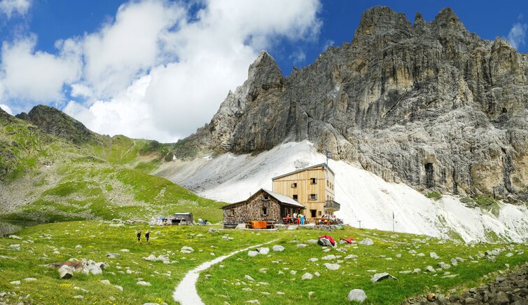
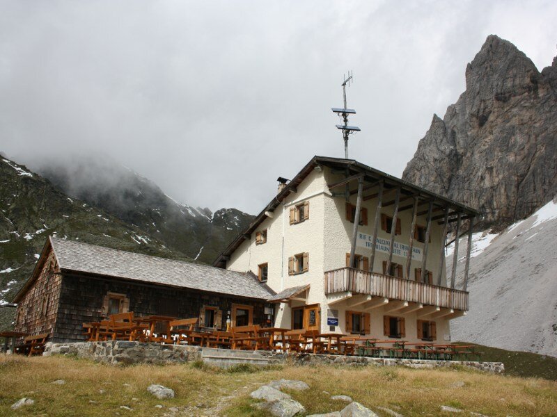
The Calciati al Tribulaun Hut is located in the southern Stubai Alps at the foot of the mighty rock walls of the Tribulaun di Fleres
Image gallery: Mountain tour to the Rifugio Calciati al Tribulaun

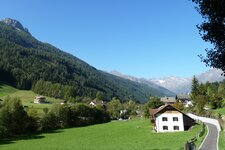
On this September day, we opt for a hut tour in Fleres. In less than ideal weather, we drive as far as Sant'Antonio, turn left there over the bridge to the hamlet of Sasso, or Stein - as it is called in German - and follow the road past the first car park to the second car park by a bridge.
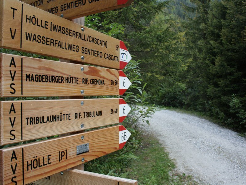
From here, we continue on foot, initially along trail no. 6, an asphalt road. We soon reach a car park, where we follow trail no. 8 towards the Cesare Calciati al Tribulaun Hut (Tribulaunhütte). It initially winds upwards in serpentines through the forest before gradually bearing right across open terrain. We pass a waterfall and reach a small roadside shrine with a spot to rest.
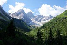
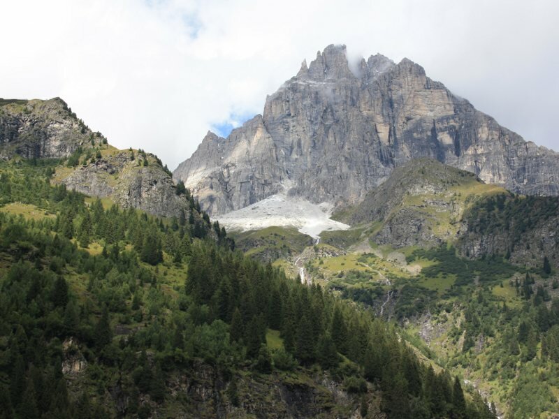
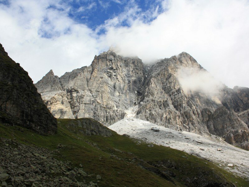
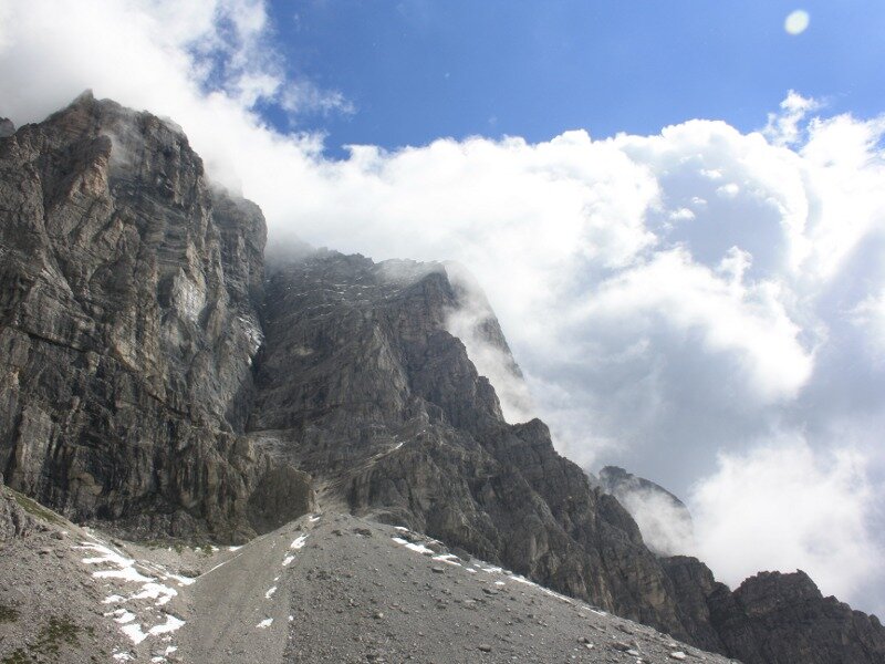
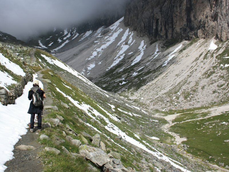
Fog initially obscures our view. We continue following the trail to the large cirque at the foot of the Tribulaun - a flat valley opens up on the left, which we enter. We see the first snow. 15 minutes later, we reach the Calciati al Tribulaun Mountain Hut by Lake Sandes at an altitude of 2,368 metres. Here the fog lifts, and we are treated to a view of the imposing local mountain of Fleres.
For the return journey, we choose the same route after stopping for a rest at the hut. The Calciati al Tribulaun Hut is also a base for various summit tours, such as those to the Dente Alto, the Forcoletta del Picco, the Goldkappl, and the Tribulaun di Fleres itself, which is shrouded in the legend of a mountain spirit. It is the only one of these mountains to exceed the 3,000-metre mark.
The Magdeburger Hütte can also be reached from here (via the Parete Bianca), as can the Austrian Tribulaunhütte, the Forcella di Fleres ridge along the Fleres High Route, and the Bremer Hütte in the Stubai Alps. Furthermore, the ascent from the Gschnitztal valley in North Tyrol is possible.
Author: BS
Experienced: September 2010
Last updated: 2026
-
- Starting point:
- parking space after the farmsteads of Sasso in Fleres di Dentro (1,374 m a.s.l.)
-
- Overall time:
- 04:45 h
-
- Total route length:
- 11,7 km
-
- Altitude:
- from 1.374 m to 2.369 m
-
- Altitude difference (uphill | downhill):
- +1000 m | -1000 m
-
- Route:
- about 12 km (in total)
-
- Signposts:
- "Wasserfallweg" (waterfall trail), no. 6, 8
-
- Destination:
- Calciati al Tribulaun Mountain Hut at Lake Sandes (2,369 m a.s.l.)
-
- Resting points:
- Calciati al Tribulaun Mountain Hut (end of June to September)
-
- Recommended time of year:
- Jan Feb Mar Apr May Jun Jul Aug Sep Oct Nov Dec
-
- Download GPX track:
- Mountain tour to the Rifugio Calciati al Tribulaun
-
- More information:
- The overall time shown above refers to the walking time only, not including breaks or stops.
We highly recommend checking the weather and trail conditions in advance and on site before starting this tour.